Rain hits Delhi amid rising heat: What's going on with the weather?
Triggered by a weak Western Disturbance, Delhi saw sudden cloud cover, gusty winds and light to moderate rain, bringing a temporary dip in temperatures without signalling the onset of monsoon.
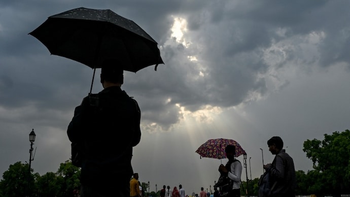
Residents of Delhi woke up to an unexpectedly hazy and cloudy skies today, offering a brief respite from the rising summer heat. Then it began raining.
The sudden change in weather is being driven by a brief meteorological phenomenon known as a Western Disturbance, a key factor behind many winters and pre-summer rain events in north India.
A Western Disturbance is essentially a low-pressure system that originates over the Mediterranean region and travels eastward, carried by high-altitude winds known as the subtropical westerly jet stream.
As it moves across countries like Iran, Afghanistan, and Pakistan, it gathers moisture from the Caspian Sea and Persian Gulf before reaching the Indian subcontinent.
When this system arrives over north India, including Delhi, it interacts with local weather conditions, particularly the intense surface heating typical of April. The warm air near the ground rises, creating instability in the atmosphere.
As the moisture-laden Western Disturbance overlaps with this unstable air, it triggers cloud formation, thunderstorms, and rainfall.
According to the India Meteorological Department, the current Western Disturbance affecting Delhi is relatively weak but still capable of producing light to moderate rainfall and isolated thunderstorms.
In the plains, including Delhi, its impact is often less intense than in the Himalayan regions such as Jammu & Kashmir, Himachal Pradesh, and Uttarakhand, where it can bring heavier rain or even snowfall.
Meteorologists note that during the pre-monsoon season, these systems can also lead to sudden gusty winds, lightning, and short-lived but intense showers.
This is because the contrast between hot surface temperatures and cooler upper-air conditions enhances atmospheric instability.
While today’s rain may cool temperatures temporarily, experts caution that it does not signal the arrival of the monsoon.
Instead, it is part of a transitional weather phase common in north India during late spring. Once the Western Disturbance passes, temperatures are expected to rise again.
Such weather events highlight the dynamic nature of Delhi’s climate, where even a weak disturbance can disrupt heatwave conditions, if only briefly.
Residents of Delhi woke up to an unexpectedly hazy and cloudy skies today, offering a brief respite from the rising summer heat. Then it began raining.
The sudden change in weather is being driven by a brief meteorological phenomenon known as a Western Disturbance, a key factor behind many winters and pre-summer rain events in north India.
A Western Disturbance is essentially a low-pressure system that originates over the Mediterranean region and travels eastward, carried by high-altitude winds known as the subtropical westerly jet stream.
As it moves across countries like Iran, Afghanistan, and Pakistan, it gathers moisture from the Caspian Sea and Persian Gulf before reaching the Indian subcontinent.
When this system arrives over north India, including Delhi, it interacts with local weather conditions, particularly the intense surface heating typical of April. The warm air near the ground rises, creating instability in the atmosphere.
As the moisture-laden Western Disturbance overlaps with this unstable air, it triggers cloud formation, thunderstorms, and rainfall.
According to the India Meteorological Department, the current Western Disturbance affecting Delhi is relatively weak but still capable of producing light to moderate rainfall and isolated thunderstorms.
In the plains, including Delhi, its impact is often less intense than in the Himalayan regions such as Jammu & Kashmir, Himachal Pradesh, and Uttarakhand, where it can bring heavier rain or even snowfall.
Meteorologists note that during the pre-monsoon season, these systems can also lead to sudden gusty winds, lightning, and short-lived but intense showers.
This is because the contrast between hot surface temperatures and cooler upper-air conditions enhances atmospheric instability.
While today’s rain may cool temperatures temporarily, experts caution that it does not signal the arrival of the monsoon.
Instead, it is part of a transitional weather phase common in north India during late spring. Once the Western Disturbance passes, temperatures are expected to rise again.
Such weather events highlight the dynamic nature of Delhi’s climate, where even a weak disturbance can disrupt heatwave conditions, if only briefly.

