El Nino set in: How it will trap India in dangerous heat, drought cycle
El Nino is bending India's monsoon out of shape, with sudden storms giving way to returning heat and the threat of drought. Here is the science of why the rains are breaking, why there is no shield this year, and what it means for farms and food prices.
For as long as anyone can remember, India has kept time by the rain. The monsoon arrives each June like a promise kept, drumming on tin roofs, darkening the dust, turning brown fields a sudden, grateful green. It is the country's oldest clock, and its most trusted.
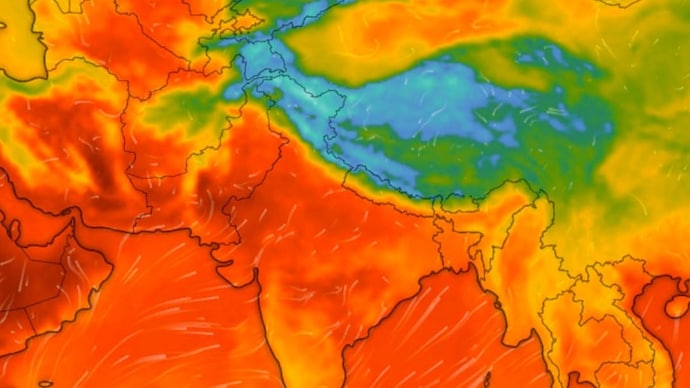
This year, the clock is keeping strange time. The rain comes in fits and starts: a thunderstorm one evening, the heat creeping back the next. Delhi is soaked by a sudden squall while, a few states away, the ground still cracks in the Sun.
The steady rhythm the country leans on has begun to stutter.
Behind the unease is a single force gathering far away in the Pacific. Its name is El Nino.
WHAT IS HAPPENING IN THE PACIFIC?
El Nino is the warm phase of a natural climate cycle called the El Nino Southern Oscillation, or ENSO. Normally, steady winds known as the trade winds push warm surface water across the Pacific towards Asia. During El Nino, those winds weaken, and the warm water slides back eastward.
That shift drags the band of rising, rain-making air away from India, out over the central Pacific. Scientists watch this warming in a patch of ocean called the Nino 3.4 region, where temperatures have already crossed the threshold for El Nino.
The World Meteorological Organization, the UN weather body, has confirmed El Nino is developing, with an 80 per cent chance of it taking hold by August and 90 per cent after that. It is expected to keep strengthening towards September.
A MONSOON IN FITS AND STARTS
A healthy monsoon is steady. It soaks the soil over four months. El Nino breaks that rhythm, turning the season staccato, long dry spells split by sudden, violent downpours.
The reason is heat. With fewer clouds and less rain, the land bakes, deepening drought and heat.
But warmer air also holds more moisture. When it lets go, it does so all at once, dumping rain that floods rather than nourishes.
Recent research shows that even as total monsoon rainfall falls in an El Nino year, the heaviest downpours can grow more frequent over central India. Drought and deluge, in the same season.
WHY INDIA HAS NO SHIELD THIS YEAR
India is not always helpless. A separate pattern called the Indian Ocean Dipole, a temperature tug-of-war across the Indian Ocean, can sometimes pull extra rain towards India and cancel out El Nino.
In 1997, it did exactly that, sparing India from a monster El Nino.
This year, the Indian Ocean Dipole is flat and neutral.
There is no counterweight. El Nino has a clear run at the monsoon.
WHAT IT MEANS FOR INDIA
The monsoon delivers about 70 per cent of India's yearly rain, and more than half its farmland has no irrigation.
The India Meteorological Department has forecast below-normal rainfall at 90 per cent of the Long Period Average, the 50-year rainfall benchmark, with a 60 per cent chance of a deficient season.
This is more than a weather story. It is a systemic shock, where a faltering monsoon collides with heat, strained power grids and the kharif season, the summer crops sown with the rains that millions of farmers depend on.
The rain will still come. The fear this year is that it no longer keeps time, falling in bursts and silences instead of the steady season the country was built around.
For as long as anyone can remember, India has kept time by the rain. The monsoon arrives each June like a promise kept, drumming on tin roofs, darkening the dust, turning brown fields a sudden, grateful green. It is the country's oldest clock, and its most trusted.
This year, the clock is keeping strange time. The rain comes in fits and starts: a thunderstorm one evening, the heat creeping back the next. Delhi is soaked by a sudden squall while, a few states away, the ground still cracks in the Sun.
The steady rhythm the country leans on has begun to stutter.
Behind the unease is a single force gathering far away in the Pacific. Its name is El Nino.
WHAT IS HAPPENING IN THE PACIFIC?
El Nino is the warm phase of a natural climate cycle called the El Nino Southern Oscillation, or ENSO. Normally, steady winds known as the trade winds push warm surface water across the Pacific towards Asia. During El Nino, those winds weaken, and the warm water slides back eastward.
That shift drags the band of rising, rain-making air away from India, out over the central Pacific. Scientists watch this warming in a patch of ocean called the Nino 3.4 region, where temperatures have already crossed the threshold for El Nino.
The World Meteorological Organization, the UN weather body, has confirmed El Nino is developing, with an 80 per cent chance of it taking hold by August and 90 per cent after that. It is expected to keep strengthening towards September.
A MONSOON IN FITS AND STARTS
A healthy monsoon is steady. It soaks the soil over four months. El Nino breaks that rhythm, turning the season staccato, long dry spells split by sudden, violent downpours.
The reason is heat. With fewer clouds and less rain, the land bakes, deepening drought and heat.
But warmer air also holds more moisture. When it lets go, it does so all at once, dumping rain that floods rather than nourishes.
Recent research shows that even as total monsoon rainfall falls in an El Nino year, the heaviest downpours can grow more frequent over central India. Drought and deluge, in the same season.
WHY INDIA HAS NO SHIELD THIS YEAR
India is not always helpless. A separate pattern called the Indian Ocean Dipole, a temperature tug-of-war across the Indian Ocean, can sometimes pull extra rain towards India and cancel out El Nino.
In 1997, it did exactly that, sparing India from a monster El Nino.
This year, the Indian Ocean Dipole is flat and neutral.
There is no counterweight. El Nino has a clear run at the monsoon.
WHAT IT MEANS FOR INDIA
The monsoon delivers about 70 per cent of India's yearly rain, and more than half its farmland has no irrigation.
The India Meteorological Department has forecast below-normal rainfall at 90 per cent of the Long Period Average, the 50-year rainfall benchmark, with a 60 per cent chance of a deficient season.
This is more than a weather story. It is a systemic shock, where a faltering monsoon collides with heat, strained power grids and the kharif season, the summer crops sown with the rains that millions of farmers depend on.
The rain will still come. The fear this year is that it no longer keeps time, falling in bursts and silences instead of the steady season the country was built around.