
Bengaluru rain broke record: What was behind the storm, and will it happen again?
Such pre-monsoon showers are normal for April but serve as a reminder of how quickly weather can change in the city.
")

Bengaluru has broken its all-time April 24-hour rainfall record.
The city recorded 111 mm of rain by 8:30 am on April 30, 2026. This beats the previous high of 108.6 mm set back 15 years ago on April 19, 2001.
The strong pre-monsoon thunderstorm delivered sudden heavy showers and hail and brought the city to a standstill, and killed 7 people, including a child, after a hospital wall collapsed due to heavy rainfall.
As rain, hail and strong winds battered the city, the question arises about what caused such weather conditions in April, a month that is usually hot and mostly dry in the city?
HOW INTENSE WAS THE STORM IN BENGALURU?
The downpour turned several parts of Bengaluru into scenes of chaos. Central areas saw heavy hail, with hailstones piling up on roads and creating a white cover in places like MG Road, Trinity Circle, and around the Mahatma Gandhi Road Metro station.
Waterlogging affected low-lying spots, with roads turning into streams up to two to three feet deep in some neighbourhoods. Areas such as Indiranagar, Koramangala, BTM Layout, and near Jayadeva Hospital also reported flooding.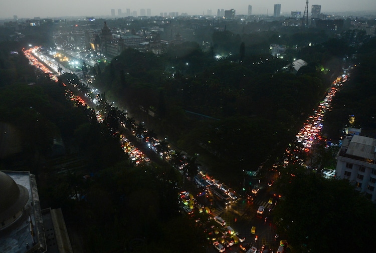
Storm-water drains, often clogged with leaves and debris, overflowed quickly and Bengaluru’s never-ending traffic came to a near standstill in many parts of the city during peak hours.
Commuters faced long delays, with some choosing to switch to the metro to get home.
Trees fell in strong winds, and there were reports of disruptions near major roads leading to the airport. The heavy rain also damaged property in a few spots.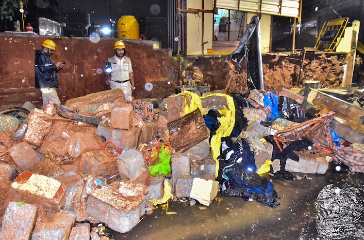
The sudden storm brought some relief from the recent heat but created problems for daily life.
WHAT CAUSED THE INTENSE STORM IN BENGALURU?
Experts say the hail and heavy rain came from strong convective activity, which occurs when rising temperatures create instability in the atmosphere.
This was further boosted by moisture coming in and a low-level wind discontinuity, which allowed tall clouds to form quickly. These conditions are common in the pre-monsoon season in southern India, when hot air rises fast and mixes with moist air, leading to thunderstorms and sometimes hail. Gusty winds, reported to be up to 75 kmph in some places, further added to the intensity.
WILL IT RAIN AGAIN TODAY?
The India Meteorological Department (IMD) had forecast thunderstorms, but the system shifted and became stronger than expected over Bengaluru.
But the spell is not over yet as more rain is likely today. Bengaluru today could see moderate to heavy rains in the evening.
Residents are advised to stay alert for possible waterlogging and traffic issues.
Such pre-monsoon showers are normal for April but serve as a reminder of how quickly weather can change in the city.