
Watch: Super Typhoon Sinlaku, strongest 2026 storm, looks monstrous from space
The storm developed in mid-April over the North Pacific Ocean and rapidly strengthened as it moved toward the Mariana Islands.
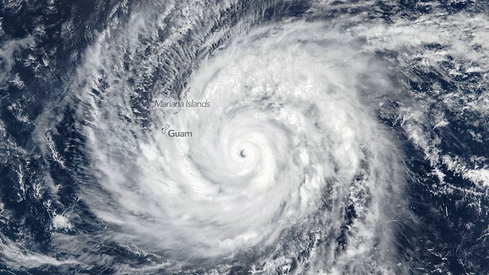

In a stunning view from orbit, the eye of Super Typhoon Sinlaku, now the strongest storm of 2026, has been captured in dramatic detail from space, revealing the sheer power of one of the year’s earliest Category 5 systems.
The footage, recorded by high-resolution cameras aboard the International Space Station, shows the storm’s massive, well-defined eye surrounded by dense, spiralling cloud walls. With wind speeds reaching up to around 280 kmph, Sinlaku has intensified into a violent typhoon, the highest category on the scale used by the Japan Meteorological Agency and equivalent to a Category 5 hurricane.
The storm developed in mid-April over the North Pacific Ocean and rapidly strengthened as it moved toward the Mariana Islands.
Satellite imagery from the Suomi NPP, equipped with the VIIRS instrument, captured the typhoon on April 13 as it approached the region. At the time, Sinlaku already had sustained winds of nearly 175 mph.
By April 14, the typhoon continued its northwest track, bringing heavy rain and dangerous conditions to islands including Saipan, Tinian and Rota. According to updates from the National Weather Service, typhoon conditions were expected to persist through April 15 before weakening into a tropical storm.
Beyond its destructive winds, Sinlaku has also drawn scientific attention for its atmospheric impact. While the storm formed in the troposphere, the lowest layer of Earth’s atmosphere, it generated striking gravity waves that extended far higher.
These waves were captured at night by the NOAA-20 satellite, where they appeared as glowing ripples in the mesosphere, made visible through a phenomenon known as airglow.
Meteorologists note that Sinlaku is only the second Category 5 storm of 2026, following Cyclone Horacio earlier this year. What makes it particularly unusual is its timing, such powerful typhoons are rarely seen this early in the season in the Northwestern Pacific.
At the same time, multiple storms have been active across the globe, including Tropical Cyclones Maila and Vaianu, highlighting an unusually intense start to the year’s cyclone activity.