
Western disturbance to begin rolling in, monsoon to advance further on Thursday
A fresh Western Disturbance is set to bring thundersqualls, hail and dust storms across parts of North and central India. The change comes as the southwest monsoon advances further and temperatures in the northwest are forecast to ease.
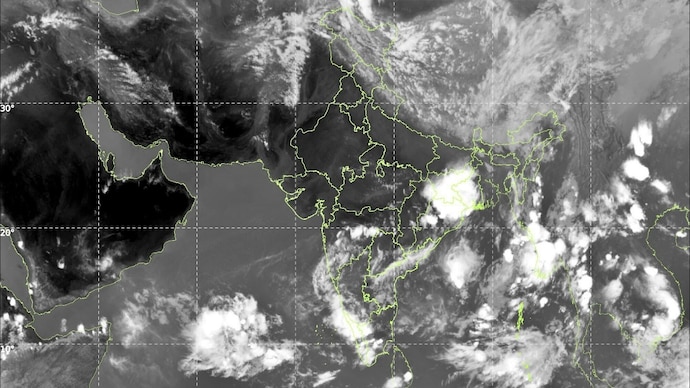

Wednesday was another tale of two weather systems pulling in opposite directions.
The south saw plenty of action, with Andaman & Nicobar Islands being drenched at most stations, while Telangana, Rayalaseema, coastal parts of Andhra Pradesh, Karnataka, and Lakshadweep all receiving significant rainfall.
Bhoothpur in Telangana's Mahabubnagar district recorded the highest single-station rainfall of the day at 11 cm. Heavy rain was also observed in parts of Andhra Pradesh, Telangana, Rayalaseema, Tamil Nadu and Karnataka, and hailstorms struck isolated spots in Marathwada and Uttarakhand.
Up north and across central India, the story was very different.
Heat wave to severe heat wave conditions continued to grip East Uttar Pradesh, with heat wave conditions also prevailing across Haryana, West Uttar Pradesh, West and East Madhya Pradesh, Vidarbha, and Chhattisgarh.
In light of the lingering heat, Prime Minister Narendra Modi issued an advisory, urging citizens to prioritise safety as temperatures soar. He emphasized staying hydrated, carrying water bottles, and offering water to others in need.
PM Modi advised monitoring signs of heat exhaustion such as dizziness and fatigue, while encouraging people to regularly check on elderly family members. He also appealed for compassion towards wildlife, asking citizens to place water bowls for birds and animals.
STORMS TO STRIKE ON THURSDAY
Thursday is set to shift the tone for North India. Tomorrow is the day north and central India have been waiting for.
A fresh Western Disturbance arrives from May 28, and it is packing serious force.
As a result, forecast for Punjab, Haryana, Chandigarh & Delhi, and West Uttar Pradesh, include thundersqualls with speeds of 60–70 kmph gusting up to 80 kmph.
East Uttar Pradesh faces similarly dangerous squalls, while isolated hailstorms are expected across Uttar Pradesh, Gangetic West Bengal, Haryana, Delhi, Himachal Pradesh, Punjab, and Uttarakhand.
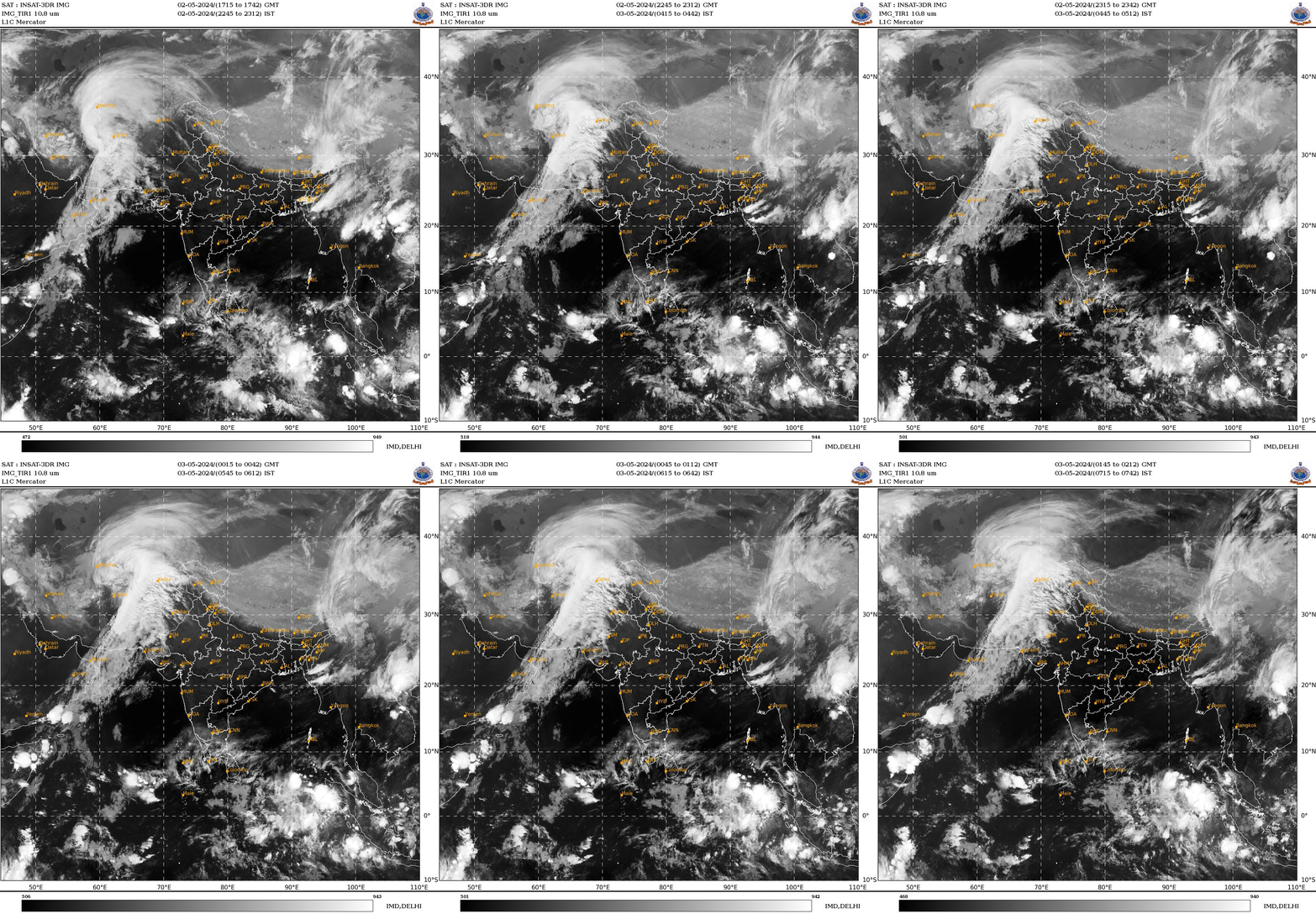
Powerful thundersqualls of 50–60 kmph are also likely over Andhra Pradesh, East Uttar Pradesh, Jammu & Kashmir, Jharkhand, Odisha, Rajasthan, and Uttarakhand.
Furthermore, dust storms are forecast for Rajasthan and Uttar Pradesh, and heavy rainfall is expected at isolated spots in Assam & Meghalaya, Bihar, Nagaland, Manipur, Mizoram & Tripura, and Tamil Nadu & Puducherry.
Despite all this storm activity, heat wave conditions will still be present in several regions, including Chhattisgarh, East Rajasthan, Haryana, Delhi, Himachal Pradesh, Goa, Odisha, Punjab, Telangana, Uttar Pradesh, and West Madhya Pradesh, with severe heat wave conditions very likely in East Madhya Pradesh, Vidarbha, and West Rajasthan.
MONSOON DELAYED BUT NOT TOO FAR AWAY
There is genuinely good news on the horizon, too.
India's life-giving seasonal rain system, called southwest monsoon, made further headway on Wednesday, advancing into parts of the southwest and southeast Arabian Sea, Lakshadweep, the Bay of Bengal, and the remaining parts of the Andaman Sea.
Conditions are expected to remain favourable for it to push further north over the next two to three days.
More immediately, temperatures across Northwest India are forecast to fall by 6-8°C between May 28 and May 30, which would mark a much-needed drop after weeks of punishing heat.
For millions baking across Uttar Pradesh, Delhi, Punjab, and Haryana, the worst may finally be almost over. Monsoon is late, but as the adage goes, better late than never.