
El Nino is stirring again: Why India's monsoon could fall short in 2026
El Nino conditions are developing in the Pacific Ocean, with the WMO putting the odds at 80 per cent for June to August 2026. Here is what the warming ocean means for India's already below normal monsoon and the months ahead.
")
El Nino is developing in the Pacific, and the WMO puts the odds at 80 per cent for this summer. Here is what it could mean for India's monsoon, which the IMD already expects to be below normal in 2026. (Photo: Windy)

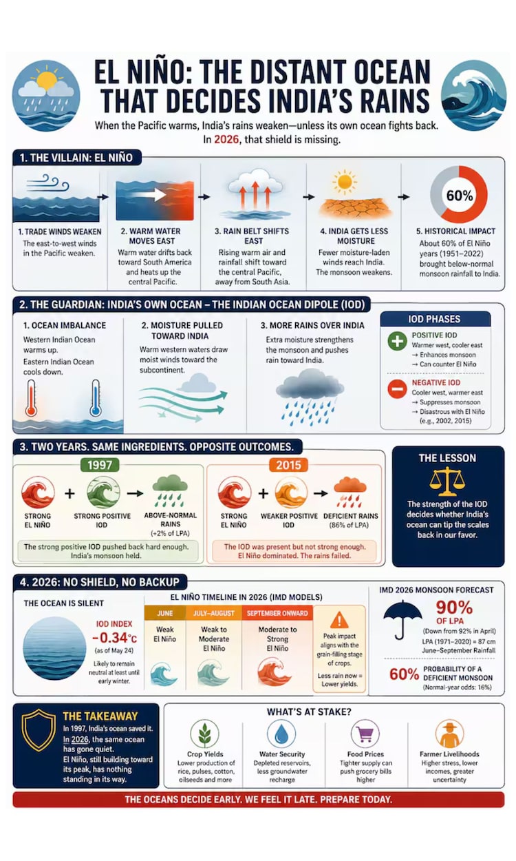
The Pacific Ocean is heating up, and scientists around the world are paying close attention. After a quiet, neutral spell earlier this year, the great climate see-saw of the tropical Pacific is tilting once again, and this time it points towards El Nino.
For India, where the monsoon shapes everything from food prices to farmers' fortunes, that single phrase carries real weight.
WHAT EXACTLY IS EL NINO?
El Nino is the warm phase of a natural cycle called the El Nino Southern Oscillation, or ENSO.
Picture the equatorial Pacific as a giant bathtub of warm water that normally piles up near Asia and Australia.
During El Nino, the trade winds that hold that warmth in place go slack, and it sloshes eastward towards South America. Scientists track this through a patch of ocean called the Nino 3.4 region, in the central Pacific.
When sea surface temperatures there, simply the warmth of the topmost layer of water, stay at least 0.5 degrees Celsius above average for a sustained spell, an El Nino is declared.
THE PACIFIC IS WARMING FAST
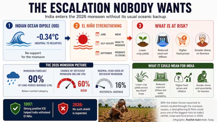
That threshold has now been crossed. The World Meteorological Organization, the United Nations weather body, confirmed on June 2 that El Nino conditions are developing, and put the chance of a full event between June and August 2026 at 80 per cent.
That likelihood rises to around 90 per cent for the rest of the year. Weekly readings in the Nino 3.4 region have surged close to one degree above normal.
Tellingly, a pool of unusually warm water is also sitting below the surface.
This subsurface warmth acts like a hidden fuel tank, hinting that the event could strengthen rather than fizzle out.
WHY INDIA SHOULD WATCH CLOSELY
Here is where it gets personal. El Nino nudges the atmosphere's rainfall engine eastward, away from the subcontinent, and historically this has meant a weaker monsoon.
The India Meteorological Department (IMD) has already forecast a below normal season, pegging rainfall at 90 per cent of the long period average, the benchmark drawn from decades of records.
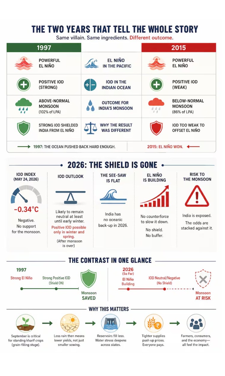
That sits right on the edge of deficient, defined as below 90 per cent, and the IMD sees a 60 per cent chance of landing there. The monsoon itself reached Kerala on June 4, three days later than its usual June 1 date.
Forecasters expect a steady advance across Karnataka, Andhra Pradesh and Tamil Nadu in the days ahead.
WHAT HAPPENS NEXT
El Nino usually peaks between November and February and can linger into the following year.
Stacked on top of the steady warming driven by human activity, it raises the odds of heatwaves and erratic rainfall worldwide. For now, the message from scientists is simple.
The Pacific has spoken, and the months ahead deserve a watchful eye.
- Ends