
Heavy rain shortly: Satellite shows big cloud surge, yellow alert in these states
A western disturbance visible on INSAT-3DS imagery has triggered yellow alerts across the Himalayan states. The same satellite view also shows strengthening monsoon signals near Kerala, pointing to an early onset window.

The India Meteorological Department (IMD) has issued a yellow alert for rain, thunderstorms, and gusty winds across several Himalayan states as a heavy weather system moves eastward, bringing unstable weather conditions to the region.
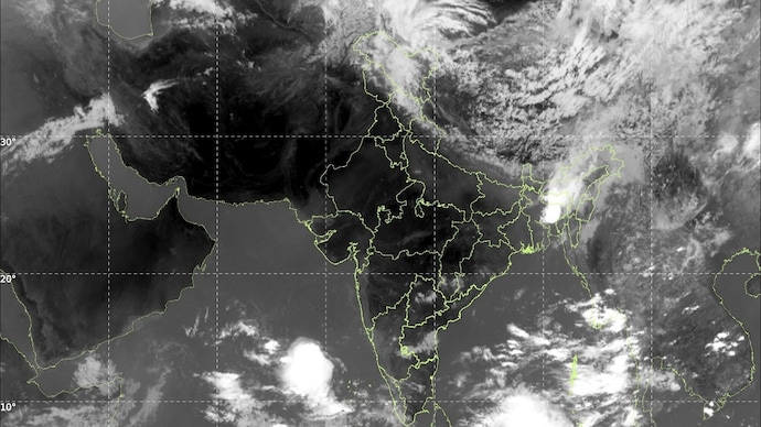
A massive western disturbance sweeping across upper reaches of North India is clearly visible in the latest INSAT-3DS thermal infrared satellite imagery, with a huge spiral-shaped cloud mass stretching across Jammu & Kashmir, Himachal Pradesh and Uttarakhand.
The satellite image shows dense, cold cloud tops curling over the western Himalayas, a classic signature of an active western disturbance interacting with hot pre-monsoon air over North India.
Bright white cloud bands over Jammu & Kashmir and Himachal Pradesh indicate towering thunderclouds with strong vertical development, capable of producing intense rainfall, lightning and localized hailstorms.
At the same time, another major weather story is unfolding over southern India.
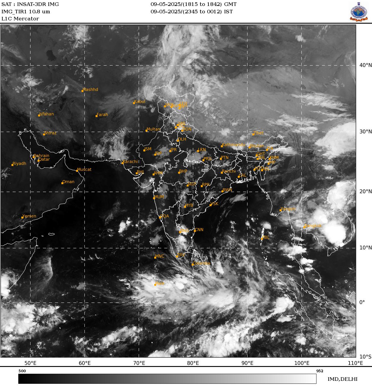
Over the Arabian Sea and the southern peninsula, large clusters of deep convective clouds are building rapidly near Kerala and Lakshadweep, signalling strengthening monsoon activity.
The clouding pattern suggests increasing moisture transport from the equatorial Indian Ocean into the Kerala coast, one of the clearest early indicators of the southwest monsoon’s arrival.
The IMD has already issued a yellow alert for rain in Kerala and maintained that monsoon onset is likely around May 26, earlier than the normal June 1 onset date. If it arrives on schedule, this would mark one of the earlier monsoon entries in recent years.
The satellite imagery strongly supports this forecast. Thick cloud bands are visible southwest of Kerala, while vigorous thunderstorm clusters are forming over the southeast Arabian Sea.
Meteorologists typically look for persistent deep clouding, strengthening westerly winds and falling outgoing longwave radiation before declaring monsoon onset, and many of those signals now appear to be falling into place.
The IMD has also warned of isolated heavy to very heavy rainfall across parts of Kerala between May 28 and June 3 as the monsoon current strengthens further. Such intense rainfall episodes are common during the burst phase of monsoon onset, when enormous quantities of moisture suddenly move inland.

Meanwhile, much of northwest and central India remains under severe heatwave conditions. The clash between extremely hot continental air and incoming moist systems is helping fuel violent thunderstorm development across northern India.
In the satellite image, this atmospheric battle is almost visible in real time: scorching dry air dominates central India, while giant cloud shields churn simultaneously over the Himalayas and the Arabian Sea, a sign that India is now entering the dramatic transition period between peak summer and the arrival of the monsoon.