Delhi records coldest April day in 11 years. What will Saturday be like?
Delhi recorded its coolest April day in a decade on April 9, with temperatures plunging to 28.2 degrees Celsius following an active Western Disturbance. The IMD forecasts clear skies and pleasant weather on 10 April, but a sharp warming trend begins from the weekend.
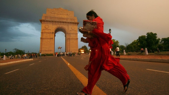
North India was hit by widespread rain and hailstorms on April 7 and 8, due to a western disturbance, which is a moisture-laden weather system that originates over the Mediterranean and tracks eastward into the Indian subcontinent.
This brought temperatures across the northwest down to seven degrees Celsius below normal.
On April 9, Delhi’s Safdarjung Observatory recorded a maximum of just 28.2 degrees Celsius, the coolest April day in the city in about a decade, according to the India Meteorological Department.
IS DELHI GETTING PLEASANT WEATHER ON APRIL 10?
On Friday, April 10, Delhi-NCR will see mainly clear skies, with daytime temperatures in the range of 32 to 34 degrees Celsius and night temperatures between 16 and 18 degrees Celsius.
Strong north-westerly winds of 20 to 30 kilometres per hour are expected during the day, adding a brisk, cooling edge even as the sun returns. No rain is forecast. The pleasant window is brief, however.
The IMD warns of a gradual rise of eight to 10 degrees Celsius in maximum temperatures across northwest plains between 9 and 15 April.
By April 12, Delhi's daytime high could climb to 35 to 37 degrees Celsius, and conditions will turn above normal shortly after.
WHERE WILL IT RAIN IN INDIA ON APRIL 10?
While the north dries out, the northeast and parts of the east stay wet.
The IMD forecasts light to moderate rain with isolated heavy spells over Sikkim, Sub-Himalayan West Bengal, Arunachal Pradesh, Assam, and coastal Odisha on April 10.
Heavy rainfall is specifically expected over Arunachal Pradesh on April 9 and 10.
Thunderstorm activity is also likely over Assam and Meghalaya during the week. The rest of the country, from central India to the south, will remain largely dry.
WHAT IS THE BIGGER WEATHER PICTURE FOR INDIA?
The current transition from wet to dry is governed by three global climate engines. The most immediate driver is the Madden-Julian Oscillation, or MJO.
Think of the MJO as a massive, travelling pulse of clouds and rain that circles the equator every 30 to 60 days. It has an active phase that brings rain and a suppressed phase that brings dry weather.
Currently, the MJO is in Phase 6 and moving towards Phase 8 by the second week of April. In these phases, the rainy part of the pulse is focused over the Pacific Ocean.
Because air is rising there to create storms, it must sink elsewhere to balance the atmosphere. That sinking air is landing over India, acting like a giant lid that prevents clouds from forming.
This is why the IMD says most of India will stay drier than normal in the near term.
Meanwhile, the long-term heavyweights of Indian weather, ENSO (El Nino Southern Oscillation) and the Indian Ocean Dipole, are currently in neutral states.
ENSO is the temperature see-saw in the Pacific, where the El Nino weather phenomenon usually brings drought and La Nina brings floods. Similarly, the Indian Ocean Dipole is a temperature swing between the African and Indonesian coasts.
Because both are neutral, they are not pushing the weather toward any extremes. This leaves the stage open for the MJO to dictate the forecast.
Despite the dry outlook, Northwest India’s pre-monsoon rainfall for the week ending on April 8 was a striking 158 per cent above normal.
This reflects just how active the recent Western Disturbances were, though their influence is now fading as the MJO’s dry phase takes over.
North India was hit by widespread rain and hailstorms on April 7 and 8, due to a western disturbance, which is a moisture-laden weather system that originates over the Mediterranean and tracks eastward into the Indian subcontinent.
This brought temperatures across the northwest down to seven degrees Celsius below normal.
On April 9, Delhi’s Safdarjung Observatory recorded a maximum of just 28.2 degrees Celsius, the coolest April day in the city in about a decade, according to the India Meteorological Department.
IS DELHI GETTING PLEASANT WEATHER ON APRIL 10?
On Friday, April 10, Delhi-NCR will see mainly clear skies, with daytime temperatures in the range of 32 to 34 degrees Celsius and night temperatures between 16 and 18 degrees Celsius.
Strong north-westerly winds of 20 to 30 kilometres per hour are expected during the day, adding a brisk, cooling edge even as the sun returns. No rain is forecast. The pleasant window is brief, however.
The IMD warns of a gradual rise of eight to 10 degrees Celsius in maximum temperatures across northwest plains between 9 and 15 April.
By April 12, Delhi's daytime high could climb to 35 to 37 degrees Celsius, and conditions will turn above normal shortly after.
WHERE WILL IT RAIN IN INDIA ON APRIL 10?
While the north dries out, the northeast and parts of the east stay wet.
The IMD forecasts light to moderate rain with isolated heavy spells over Sikkim, Sub-Himalayan West Bengal, Arunachal Pradesh, Assam, and coastal Odisha on April 10.
Heavy rainfall is specifically expected over Arunachal Pradesh on April 9 and 10.
Thunderstorm activity is also likely over Assam and Meghalaya during the week. The rest of the country, from central India to the south, will remain largely dry.
WHAT IS THE BIGGER WEATHER PICTURE FOR INDIA?
The current transition from wet to dry is governed by three global climate engines. The most immediate driver is the Madden-Julian Oscillation, or MJO.
Think of the MJO as a massive, travelling pulse of clouds and rain that circles the equator every 30 to 60 days. It has an active phase that brings rain and a suppressed phase that brings dry weather.
Currently, the MJO is in Phase 6 and moving towards Phase 8 by the second week of April. In these phases, the rainy part of the pulse is focused over the Pacific Ocean.
Because air is rising there to create storms, it must sink elsewhere to balance the atmosphere. That sinking air is landing over India, acting like a giant lid that prevents clouds from forming.
This is why the IMD says most of India will stay drier than normal in the near term.
Meanwhile, the long-term heavyweights of Indian weather, ENSO (El Nino Southern Oscillation) and the Indian Ocean Dipole, are currently in neutral states.
ENSO is the temperature see-saw in the Pacific, where the El Nino weather phenomenon usually brings drought and La Nina brings floods. Similarly, the Indian Ocean Dipole is a temperature swing between the African and Indonesian coasts.
Because both are neutral, they are not pushing the weather toward any extremes. This leaves the stage open for the MJO to dictate the forecast.
Despite the dry outlook, Northwest India’s pre-monsoon rainfall for the week ending on April 8 was a striking 158 per cent above normal.
This reflects just how active the recent Western Disturbances were, though their influence is now fading as the MJO’s dry phase takes over.

