
Rain and storm lower temperatures in north India: How long will the relief last?
This brief respite highlights how erratically the weather has been behaving in 2026, with the overall trend pointing towards potentially record-breaking summer days ahead.
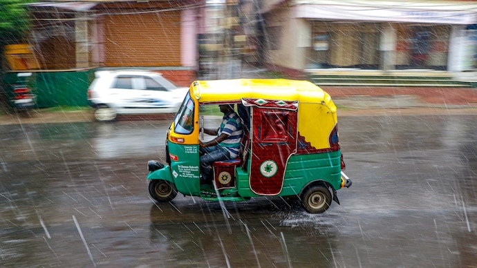

Heavy showers, thunderstorms, and strong winds swept through Delhi and nearby areas early on April 29, 2026, bringing quick relief from the recent intense heat.
The sudden weather change resulted in many places seeing temperatures drop sharply in the morning hours.
Thunderstorms and rain hit Delhi-NCR on the morning of April 29, bringing strong gusty winds and showers. Areas like Gurgaon showed temperatures falling to around 20-25°C in several spots.
This came after Delhi had recorded highs of 39.2°C and even 42.3°C at Safdarjung in the days before, with recorded temperatures being hotter than the desert metropolitan Dubai.
The rain and clouds helped cool the air noticeably, giving people a welcome break from the scorching conditions. Similar stormy weather affected parts of North India, with lightning and gusty winds reported widely, including in parts of Bihar and Rajasthan.
The latest available readings on April 29 morning showed temperatures hovering in the low 20s across many Delhi-NCR locations, with Safdarjung and nearby stations recording around 29°C as the day progressed but feeling much cooler due to the wet and breezy conditions.
WHY DID IT RAIN?
This sudden change was caused by a western disturbance, which is a common weather system that brings moisture from the Mediterranean region into northwest India.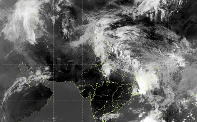
As the new wave of the weather system moved in, it triggered clouds, thunderstorms, and rain over Delhi, Haryana, and surrounding areas. It also stirred up dust storms in some places before the rain started.
These disturbances often create unstable air, leading to heavy clouds that block the sun and rains that cool the ground quickly.
Meteorologists from the India Meteorological Department (IMD) linked the cooling directly to this weather system affecting the region.
HOW LONG WILL COLD WEATHER LAST?
The cool and wet spell is unfortunately expected to be short-lived.
The influence of the current western disturbance will likely fade quickly, with most rain and stormy activity easing by the afternoon or evening of April 29.
Daytime temperatures are forecast to recover to around 36-37°C as skies clear and bring back the sizzling heat conditions.
Clearer and drier conditions should return from April 30 onwards, allowing maximum temperatures to rise further in the coming days.
By early May, the region may see a return to hotter weather, with highs climbing back toward or above 40°C in the absence of another strong weather system.
The IMD indicates that while this break offers temporary relief, another round of rain is not immediately expected, so residents should prepare for rising heat again soon, and that too, for a longer spell.
This brief respite highlights how erratically the weather has been behaving in 2026, with the overall trend pointing towards potentially record-breaking summer days ahead.